Late Wednesday evening, residents across parts of Alaska experienced a tense and uncertain moment after a massive earthquake struck near the Alaskan Peninsula, prompting tsunami warnings and emergency monitoring throughout the Pacific region.
For coastal communities, the sound of warning sirens immediately transformed an ordinary night into one filled with urgency. Families gathered essentials, emergency teams activated response plans, and officials carefully monitored ocean activity as authorities worked to assess potential risks.
Although no major destruction was immediately reported, the event served as a reminder of the immense natural forces that shape our planet and the importance of preparedness in regions vulnerable to seismic activity.
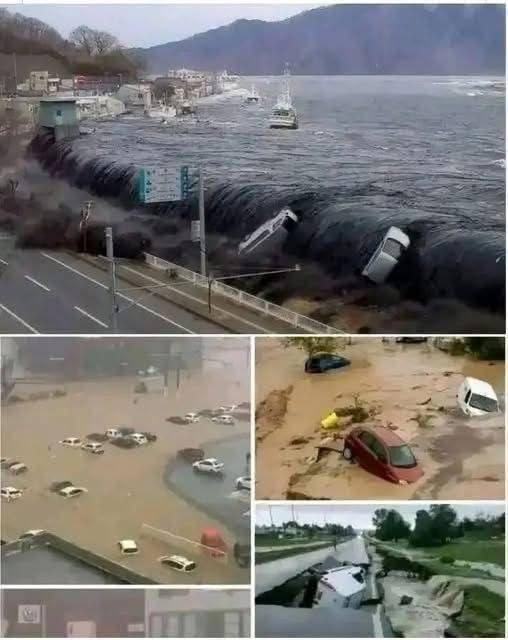
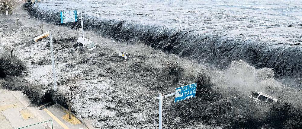
The earthquake quickly became a major topic of discussion worldwide, not only because of its strength but also because of the widespread tsunami alerts issued shortly afterward.
Where the Earthquake Occurred
According to reports, the earthquake measured magnitude 8.2 and struck near the Alaskan Peninsula at a depth of approximately 35 kilometers. The epicenter was located roughly 91 kilometers east-southeast of Perryville, Alaska.
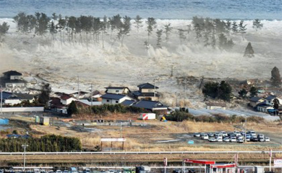
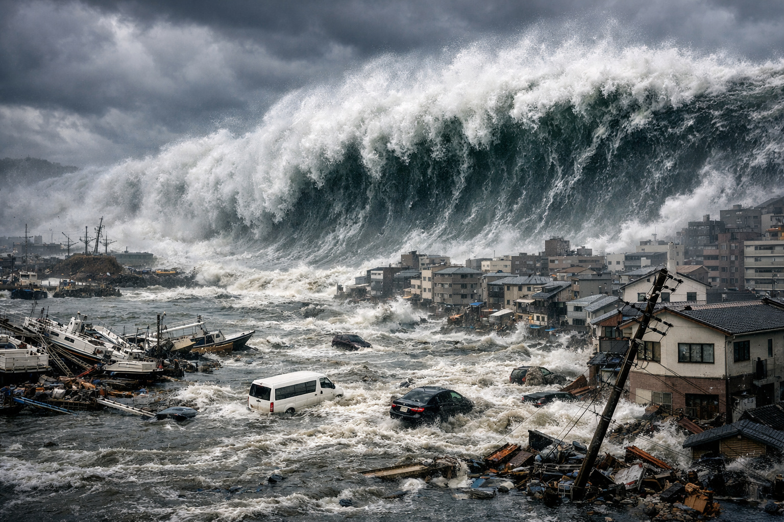
Earthquakes of this magnitude are considered extremely powerful and are capable of generating significant ocean disturbances, especially when they occur beneath or near large bodies of water.
The event triggered immediate monitoring by multiple international agencies, including the United States Geological Survey and the Pacific Tsunami Warning Center.
Scientists also recorded several aftershocks following the initial quake, including some measuring above magnitude 6.0. Aftershocks are common after major seismic events and can continue for hours, days, or even longer depending on the geological conditions.
Why Tsunami Warnings Were Issued
When large earthquakes occur near oceanic fault lines, scientists rapidly evaluate whether movement beneath the seafloor could displace enough water to generate tsunami waves.
Following the Alaska earthquake, tsunami warnings were issued for parts of southern Alaska, including coastal areas stretching from Hinchinbrook Entrance to Unimak Pass.
Authorities activated emergency protocols in several coastal communities. In places such as Kodiak, warning sirens encouraged residents to remain alert and move to safer locations as a precautionary measure.
Initial warnings were also extended to regions including Hawaii and Guam. However, those alerts were later lifted after further assessments indicated there was no major threat to those areas.
Tsunami warnings are often issued quickly following large undersea earthquakes because early preparation can save lives. In many cases, authorities prefer to act cautiously until more data becomes available.
Understanding the Science Behind Major Earthquakes
Earthquakes occur when tectonic plates beneath Earth’s surface suddenly shift, releasing enormous amounts of energy.
Alaska sits along the Pacific Ring of Fire, one of the most seismically active regions in the world. This area experiences frequent earthquakes and volcanic activity because several tectonic plates interact there.
The Ring of Fire stretches around the Pacific Ocean and includes parts of North America, South America, Japan, Indonesia, New Zealand, and other regions.
Scientists study these zones carefully because they are capable of producing some of the strongest earthquakes ever recorded.
The energy released during a magnitude 8.2 earthquake is immense. On the logarithmic Richter scale, each whole-number increase represents far greater energy release than the previous level. That means an 8.2 earthquake is dramatically stronger than a 7.2 event.
To help explain earthquake magnitude relationships, scientists often reference mathematical scaling models such as:
E∝101.5ME \propto 10^{1.5M}E∝101.5M
This relationship illustrates how energy release increases exponentially as earthquake magnitude rises.
How Modern Warning Systems Help Protect Communities
One reason large-scale natural events today often result in fewer casualties than in previous centuries is the advancement of global monitoring systems.
Organizations such as the National Tsunami Warning Center continuously monitor seismic activity using underwater sensors, satellite systems, and global communication networks.
When a potentially dangerous earthquake occurs, alerts can be distributed within minutes.
Emergency response systems now include:
Real-Time Seismic Monitoring
Thousands of sensors worldwide detect ground movement and transmit data instantly to scientific centers.
Tsunami Detection Buoys
Specialized ocean buoys measure changes in sea levels that may indicate tsunami formation.
Public Warning Networks
Authorities use mobile alerts, television broadcasts, radio systems, and sirens to inform residents quickly.
International Cooperation
Countries throughout the Pacific coordinate closely to share information and evaluate risks together.
These systems cannot prevent earthquakes, but they can significantly reduce risk by giving communities valuable preparation time.

Why Alaska Experiences Frequent Earthquakes
Alaska is one of the most earthquake-prone regions in the United States.
The state lies near the boundary where the Pacific Plate moves beneath the North American Plate, a process known as subduction. This geological interaction builds stress over time until it is released suddenly through earthquakes.
Historically, Alaska has experienced several major seismic events, including the famous 1964 Great Alaska Earthquake, which remains one of the strongest earthquakes ever recorded globally.
Scientists continue studying Alaska’s seismic activity to improve forecasting models and emergency preparedness strategies.
Public Reactions Across the Pacific
As news of the earthquake spread online, concern quickly grew across Pacific nations.
Residents in coastal regions monitored updates carefully while emergency agencies reassured the public that warning systems were functioning as intended.
Social media discussions reflected both anxiety and appreciation for rapid emergency communication. Many people praised evacuation efforts and the quick coordination between agencies.
Natural events of this scale often remind communities how interconnected global monitoring systems have become. Information now travels almost instantly across continents, allowing governments and emergency organizations to respond faster than ever before.
The Role of Preparedness During Natural Disasters
Experts consistently emphasize that preparation is one of the most important tools for reducing harm during earthquakes and tsunami threats.
Emergency preparedness recommendations often include:
Creating Emergency Supply Kits
Households in earthquake-prone regions are encouraged to keep water, food, flashlights, medications, and communication devices ready.
Knowing Evacuation Routes
Residents near coastlines benefit from understanding designated evacuation areas and higher ground locations.
Practicing Emergency Plans
Schools, workplaces, and communities regularly conduct earthquake and tsunami drills.
Staying Informed Through Official Sources
Authorities recommend following updates from recognized emergency agencies rather than relying solely on rumors or unverified online claims.
Preparedness does not eliminate uncertainty, but it can greatly improve response and safety during critical situations.
Why Earthquakes Continue to Fascinate Humanity
Earthquakes have shaped human history for thousands of years. Ancient civilizations often viewed them through mythology, religion, or spiritual symbolism long before modern geology explained tectonic activity.
Today, scientific understanding has provided clearer explanations about how and why earthquakes occur. Yet despite advances in technology, these events still inspire awe because they remind people of nature’s immense power.
The Alaska earthquake once again highlighted how quickly the natural world can command global attention. Even regions thousands of kilometers away monitored developments closely because of the interconnected nature of oceans, trade systems, and international communication.
A Reflection on Nature and Human Resilience
While the immediate danger from this earthquake appears to have lessened in many areas, the event remains a powerful reminder of the importance of scientific research, emergency preparedness, and international cooperation.
Moments like these reveal both the unpredictability of nature and the remarkable ability of communities to respond together during uncertainty.
Human curiosity about earthquakes continues because they exist at the intersection of science, survival, and wonder. Each seismic event teaches researchers more about the planet beneath our feet while reminding society of the value of preparation and resilience.
As monitoring efforts continue and aftershocks are assessed, many people across the Pacific remain attentive but hopeful that the strongest impacts have passed safely.
Sources
United States Geological Survey (USGS)
National Tsunami Warning Center
National Oceanic and Atmospheric Administration (NOAA)
Pacific Tsunami Warning Center
Federal Emergency Management Agency (FEMA)